A ground based mobile platform to measure and map canopy thermal indices in a nectarine orchard
Precise irrigation management tailored to plant water status (PWS) is paramount to sustain agriculture in a climate change and water scarcity scenario.
The Green Atlas Cartographer was equipped with two infrared temperature sensors that can rapidly measure the canopy temperature. Plant water status indices could then be calculated integrating canopy temperature data captured by the Cartographer and vapour pressure deficit readings from a local weather station.
The Cartographer was able map canopy temperature and PWS responses to four irrigation treatments, i.e. 100% of crop evapotranspiration (ETc), 40%, 20% and no irrigation application (0% ETc). The maps confirmed that the ground-based technology could provide fast, on-demand assessments to manage precision irrigation.
In summary, this study provided empirical evidence that fast (≤ 10 minutes) measurements of canopy temperature describe spatial trends of plant water status without further transformation into other indices. In addition, a CWSI derived from the relationship between canopy temperature and vapour pressure deficit from large datasets collected over two years, described both temporal and spatial trends of plant water status. Afternoon scans consistently and reliably detected spatial gradients of plant water status.
This technology can be practically implemented for (i) on-demand monitoring to manage irrigation and for the simultaneous collection of other crop parameters such as tree geometry, crop load and fruit quality.
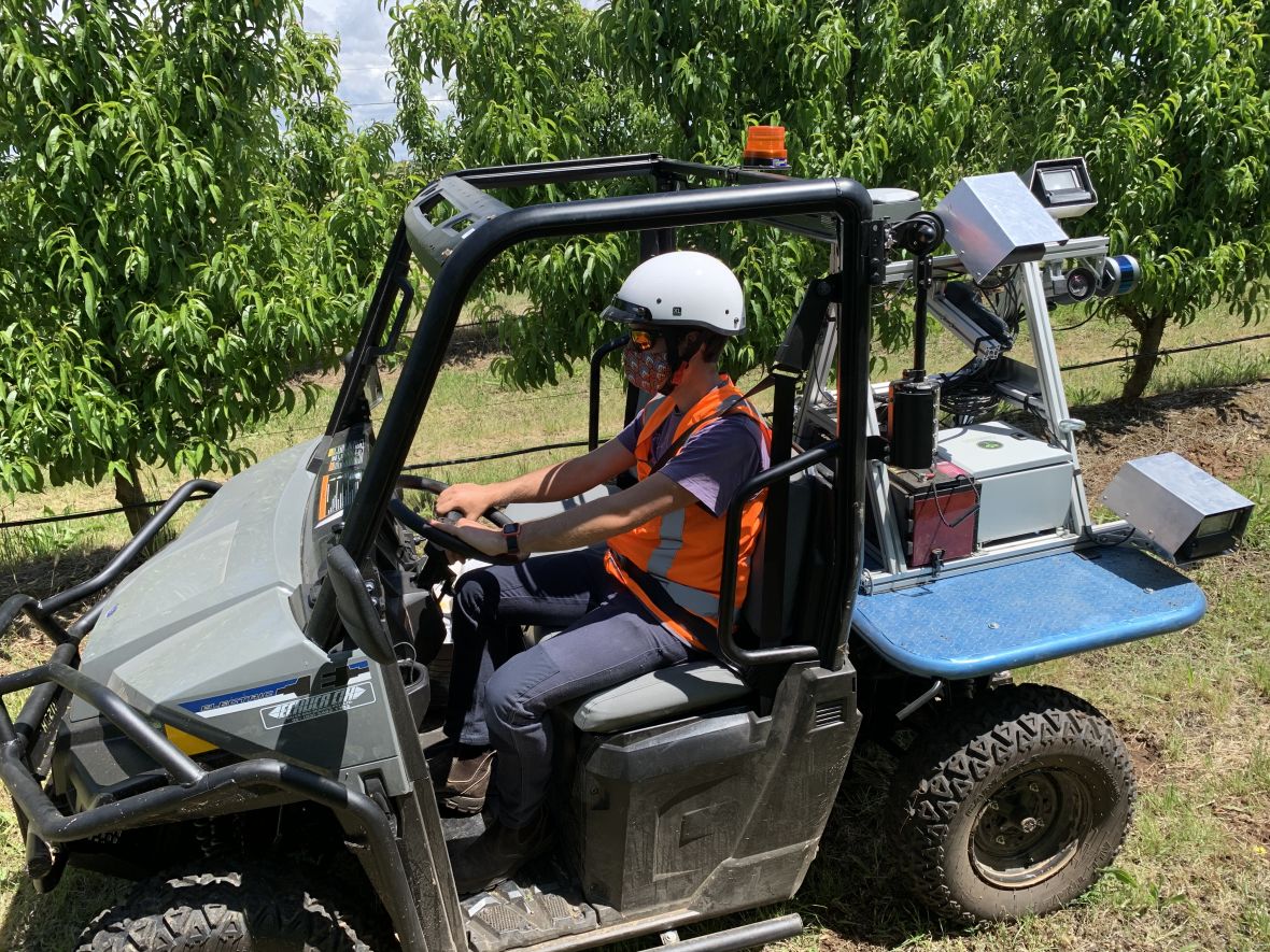
Green Atlas Cartographer
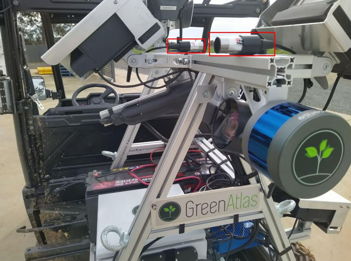
Ground based platform (Green Atlas Cartographer) equipped with Enviro-Thermal (TM) infrared sensors (Everest Interscience).
More information about the research
Poster presentation Download PDF in new window (Note: this document does not meet WCAG 2.0 accessibility guidelines)
Abstract
Precise irrigation management tailored to plant water status (PWS) is paramount to sustain agriculture in a climate change and water scarcity scenario. Canopy temperature (Tc), delta temperature [dT = Tc − ambient temperature (Ta)] and crop water stress index (CWSI) can be used to describe PWS. This study aimed to test a mobile platform sensor system (Green Atlas Cartographer equipped with infrared temperature sensors) for rapid measurements of Tc (and derivation of dT and CWSI) in a nectarine orchard. The study was conducted on mature high-density ‘September Bright’ nectarine trees under four irrigation treatments — 100 % of crop evapotranspiration (ETc), 40 % ETc, 20 % ETc and no irrigation (0 % ETc). The orchard was scanned using Cartographer to measure Tc. A local weather station was used to obtain Ta and derive dT, and two methods were used to calculate CWSI (CWSI-I, CWSI-II). Correlations of Tc, dT, CWSI-I and CWSI-II with leaf water potential (Ψleaf) and irrigation treatments were tested. Tc, dT, CWSI-I and CWSI-II were found to be significantly inversely related to Ψleaf and irrigation treatments when measurements were obtained between 1300 and 1915 h (AEDT) at different dates. CWSIII outperformed CWSI-I in describing a more realistic PWS gradient over time. Spatial maps of Tc revealed clear visual separations of deficit irrigation treatments. We contend that Tc can be used per se as a tool to assess spatial variability of PWS at single points in time when Tc measurements are taken over a relatively short timeframe where Ta and vapour pressure deficit can be considered constant. However, dT, CWSI-I and CWSI-II are the preferred indices of PWS for temporal comparisons between different days and/or times of the day. Our results confirm the suitability and utility of ground-based vehicles for fast and on-demand assessments of spatial and temporal variability of PWS in orchards.
Acknowledgements
Tatura SmartFarm, Agriculture Victoria, Tatura, Victoria. Centre for Agricultural Innovation, The University of Melbourne. Green Atlas, Alexandria, New South Wales.
This study was financially supported by the project ‘Deploying real-time sensors to meet Summerfruit export requirements’ funded by Food Agility CRC Ltd., under the Commonwealth Government CRC Program with co-investment from Agriculture Victoria and Summerfruit Australia Limited. The CRC Program supports industry-led collaborations between industry, researchers and the community.